Moreton View Tower and Villas is served by a number of convenient transport modes. The most commonly used are the City Hopper, City Ferry and the bus. Other modes such as the CityCat and train are accessed by either walking or taking a ferry ride. Translink has an online Journey Planner that gives optional routes to reach a destination.
It is cheaper to buy a TransLink electronic go card than to pay as you travel. The go card can be used on all TransLink bus, train (including Airtrain), ferry and tram services in greater Brisbane, Ipswich, Sunshine Coast and Gold Coast regions. It is:
- cheaper than the cost of a paper ticket
- convenient to manage—you just touch your card on to the electronic pad on the bus or ferry, or at the train station, at the beginning of your journey and touch off at the end. Your fare is automatically calculated and deducted from your card balance.
- easy to top-up and use
- available for adults, children, concessions and seniors.
For further information, go to the Translink website
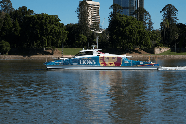
City Hopper
The City Hopper is a free ferry that runs between New Farm and North Quay. The ferry runs every 30 minutes from 6am until midnight. Because the City Hopper is free, it is very popular, especially in the rush hour.
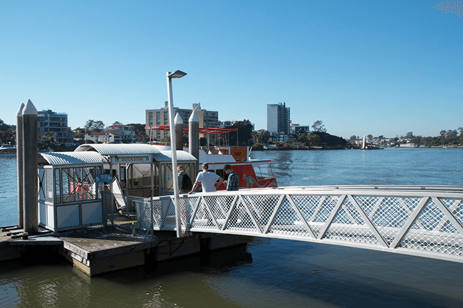
- The terminal closest to Moreton View Tower and Villas is Dockside, which is accessed by exiting the back door in the ground floor lobby and walking through the mews out on to the boardwalk and turning right. From Dockside, it is one stop to the terminus, New Farm; in the opposite direction, it is two stops to Eagle Street Pier in the city (11 minutes); five stops to SouthBank; and six stops to North Quay (40 minutes) in the city.
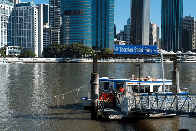
- The next closest terminal is at Thornton Street, about a seven-minute walk away. From Thornton Street terminal, it is one stop to Eagle Street Pier (less than five minutes); in the opposite direction, it is two stops to SouthBank, and three stops to North Quay (about 20 minutes travel).
- Alternatively the Holman Street Ferry is about 10-minute walk away, and is also one stop to Eagle Street Pier. For MVTV residents, there are no benefits in walking to Holman Street when going to Eagle Street Pier, but when returning from Eagle Street Pier, it provides another option if the ferry travelling to Holman Street comes first.
City Ferry
There is a charge to use the City Ferry. The City Ferry zig zags in a ‘V’ shape across the river from Thornton Street on the southside of the river over to Eagle Street Pier and then back to Holman Street; it then returns from Holman Street to Eagle Street Pier and back to Thornton Street. There are four ferries in each direction every hour. When this is combined with the City Hopper departing these terminals, there is a ferry from Thornton Street to Eagle Street Pier every ten minutes from 6am to midnight, and vice versa.
Bus
The most commonly used buses by MVTV residents are the 234, 227 and 232, especially when travelling to and from the city. They run reasonably frequently in the rush hour but less so outside the rush hour and at weekends. Woolloongabba Bus Station is a short ride away on the 234 bus (or about 20-minute walk) and connects with many other bus services. The timetables for all buses are available from Translink. Translink has an online Journey Planner that gives optional routes to reach a destination.
- 234
The 234 service runs from Woolloongabba Station (Platform 2) to Kangaroo Point and then on to Fortitude Valley and the city (several stops, including Edward Street). It then returns the same route. When travelling to the city, the closest stop for MVTV residents is at Baildon Street, opposite the Story Bridge Hotel. When returning from the city, the closest stop to alight is Stop 6 on Main Street (at the top of Ferry Street). The journey between Kangaroo Point and the city is approximately 10 minutes.
- 227 and 232
The 227 and 232 travel from the city to Wynnum and Cannon Hill respectively. The 227 travels to Wynnum via Morningside and Cannon Hill and in the opposite direction to the city via Fortitude Valley. The 232 travels to Cannon Hill Interchange (K-Mart Plaza) vie Hawthorne, Bulimba, Balmoral and Morningside, and in the opposite direction to the city.
If travelling outbound on the 227 or 232, the closest stop is stop 6 on Main Street at the top of Ferry Street. If travelling inbound, the closest stop is on Shafston Avenue at Connor Street, stop 10/6 (about 10-minute walk).
Train
The closest railway stations are Central (in the city) and Brunswick Street (Fortitude Valley).
- Central Station
Central Station is easily accessed by taking the ferry to the city followed by a 10-minute walk or the bus to the city followed by a 5–10-minute walk, depending where you alight the bus.
- Brunswick Street Station
If walking, Brunswick Street station is about 15–20-minute walk across the Story Bridge. Alternatively, the 234 bus goes to All Hallows School in Ann Street, just the other side of the bridge, followed by a 5-minute walk to the station.
CityCat
The closest CityCat terminals are at Mowbry Park (about 15-20 minutes walk away), New Farm or Riverside Ferry terminal, a short walk from Eagle Street Pier. New Farm is one stop on the City Hopper from Dockside; Eagle Street Pier is either two stops from Dockside or one stop from Thornton Street.